Thousands without power as Hurricane Francine strikes Louisiana
Widespread flooding is threatened after the Category 2 storm made landfall.

Hurricane Francine hit the Louisiana coast on Wednesday evening as a dangerous Category 2 storm which knocked out electricity to more than a quarter-million customers and threatened widespread flooding as it sent a potentially deadly storm surge rushing inland along the Gulf Coast.
Francine crashed ashore in Terrebonne Parish, about 30 miles southwest of Morgan City, the National Hurricane Centre said. Packing top sustained winds near 100mph, the hurricane battered a fragile coastal region that has not fully recovered from a series of devastating hurricanes in 2020 and 2021.
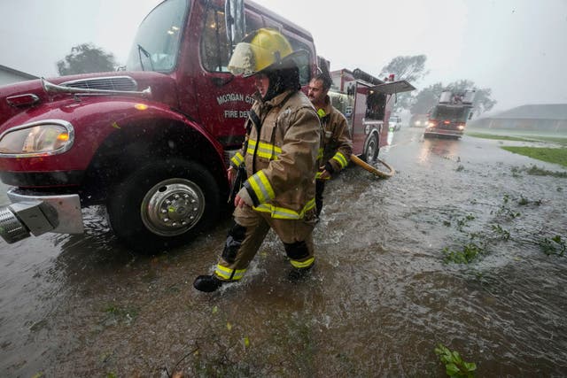
Morgan City fire chief Alvin Cockerham said the hurricane quickly flooded streets, snapped power lines and sent tree limbs crashing down.

“It’s a little bit worse than what I expected to be honest with you,” he said of the onslaught. “I pulled all my trucks back to the station. It’s too dangerous to be out there in this.”
There were no immediate reports of deaths or injuries.
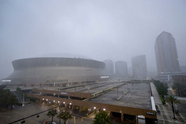
TV news broadcasts from coastal communities showed waves from nearby lakes, rivers and Gulf waters thrashing sea walls. Water poured into city streets amid blinding downpours.
As Francine continued its trek inland, it spread drenching rains over New Orleans and surrounding areas, raising flooding fears.
Power outages in Louisiana topped 261,000 hours after landfall, spread widely across southeast Louisiana. Blackouts affected the majority of homes and businesses in coastal parishes nearest where the storm came ashore as well as their inland neighbours, according to the tracking site poweroutage.us.
The National Hurricane Centre urged people to stay sheltered overnight as the weakening hurricane churned inland.

The storm’s projected path included New Orleans, where forecasters said the storm’s eye could pass through.
The sixth named storm of the Atlantic hurricane season, Francine drew fuel from exceedingly warm Gulf of Mexico waters, strengthening to a Category 2 storm with winds exceeding 96mph in the hours before landfall.
The storm began weakening as it rushed inland. Three hours after landfall it barely remained a hurricane, with top sustained winds down to 75mph. Francine was moving northeast at a fast clip of 17mph on a path toward New Orleans.
It was forecast to weaken further while pushing northward through Mississippi on Thursday, with widespread rains in the coming days bringing potential flash flooding to cities including Jackson, Mississippi, Birmingham, Alabama, Memphis, Tennessee and Atlanta. It also raised the threat of spin-off tornadoes.
Much of Louisiana and Mississippi could get 10 to 20 centimetres of rain, with the possibility of 12 inches (30 centimetres) in some spots, said Brad Reinhart, a senior hurricane specialist at the hurricane centre.
President Joe Biden granted an emergency declaration to help Louisiana secure expedited federal money and assistance.
Louisiana Governor Jeff Landry, who said the National Guard would fan out to parishes impacted by Francine, and his Mississippi counterpart Tate Reeves also declared states of emergency.


